
Aerial Intelligence
An interactive map and 3D model of your land, on a private page set up for you. Measure it, walk it, and share it — accurate to 2–5 cm horizontally and 5–10 cm vertically.
Based in Dripping Springs · Central Texas and beyond
Two ways we capture
Camera mapping and laser scanning. Every flight lands as an interactive map you can measure in, on a private page.
Aerial Mapping
Crisp aerial maps, accurate to 2–5 cm horizontally and 5–10 cm vertically
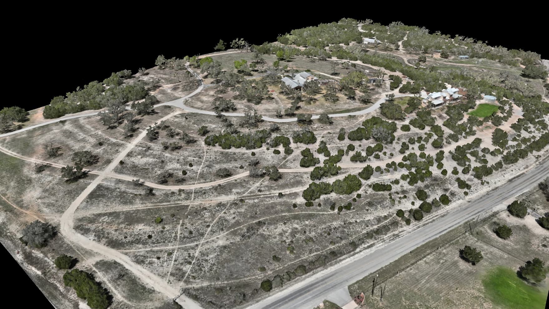
We fly your property and turn the photos into aerial maps and 3D models you can measure.
Deliverables
- Interactive viewer in any browser — private link, nothing to install
- Aerial map fine enough to read the details
- 3D model — drops straight into your design software
- 3D scan for measurements, profiles, and volumes
- Elevation map accurate to 5–10 cm vertically
- On request, a PDF flight report or a 3D-printed relief of the land
Use Cases
- •Construction progress documentation
- •Land and property mapping
- •Real estate marketing & listings
- •Earthwork verification and cut/fill
Laser Scanning
See through tree cover to the ground underneath
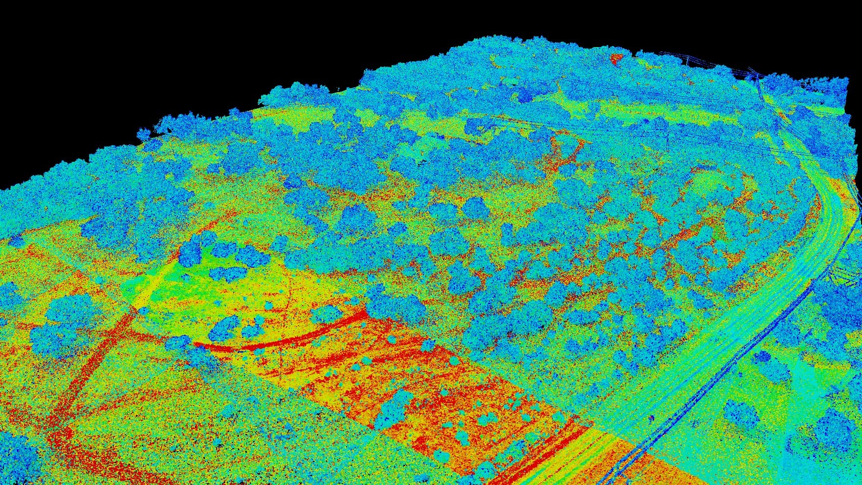
Laser scanning (LiDAR) sees through brush and canopy to the real ground. It's the answer for wooded land and terrain photos can't reach.
Deliverables
- 3D scan with ground, plants, and buildings sorted into layers
- Bare-ground terrain map with the tree cover stripped away
- Contour lines at 1–2 ft steps (DXF for CAD, KMZ for map apps)
- Tree-height analysis for forestry and land planning
Use Cases
- •Topographic mapping under tree cover
- •Drainage and grading under tree cover
- •Forest inventory and management
- •Civil engineering site analysis
What one flight produces
Our own Hill Country ranch, one layer per tap.
 Photo
PhotoThe whole property straight down, sharp enough to count fence posts — measure on it, mark it up, share it.
Flight · Aug 2026 · 0.9 cm/px
Name every place. See every trail.
Not coordinates — the North Gate, the Hay Barn, the crossing that floods first.
Waypoints, named in your words
Pin every gate, tank, blind, and crossing, and call it what you call it. Change callouts between flights read “40 m northeast of the hay barn,” not a coordinate.
Trails, on every flight
Tell us a route and we draw it once. It's on every flight after, in the map and the 3D views, stops numbered. Paper on request: a Route Card, and a Grade Sheet that measures each leg.
Your land as a toy world
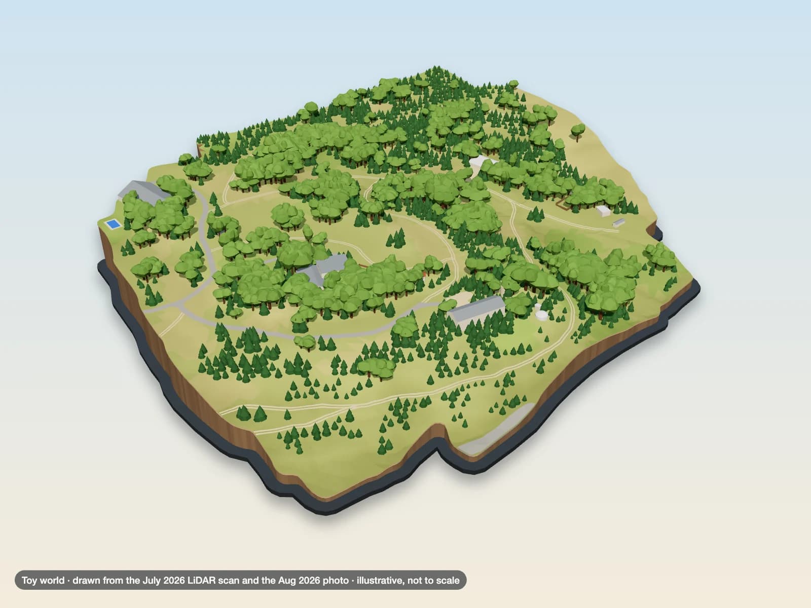
An illustrated version of your property, drawn from its own scan.
Beta
The whole place, from the side
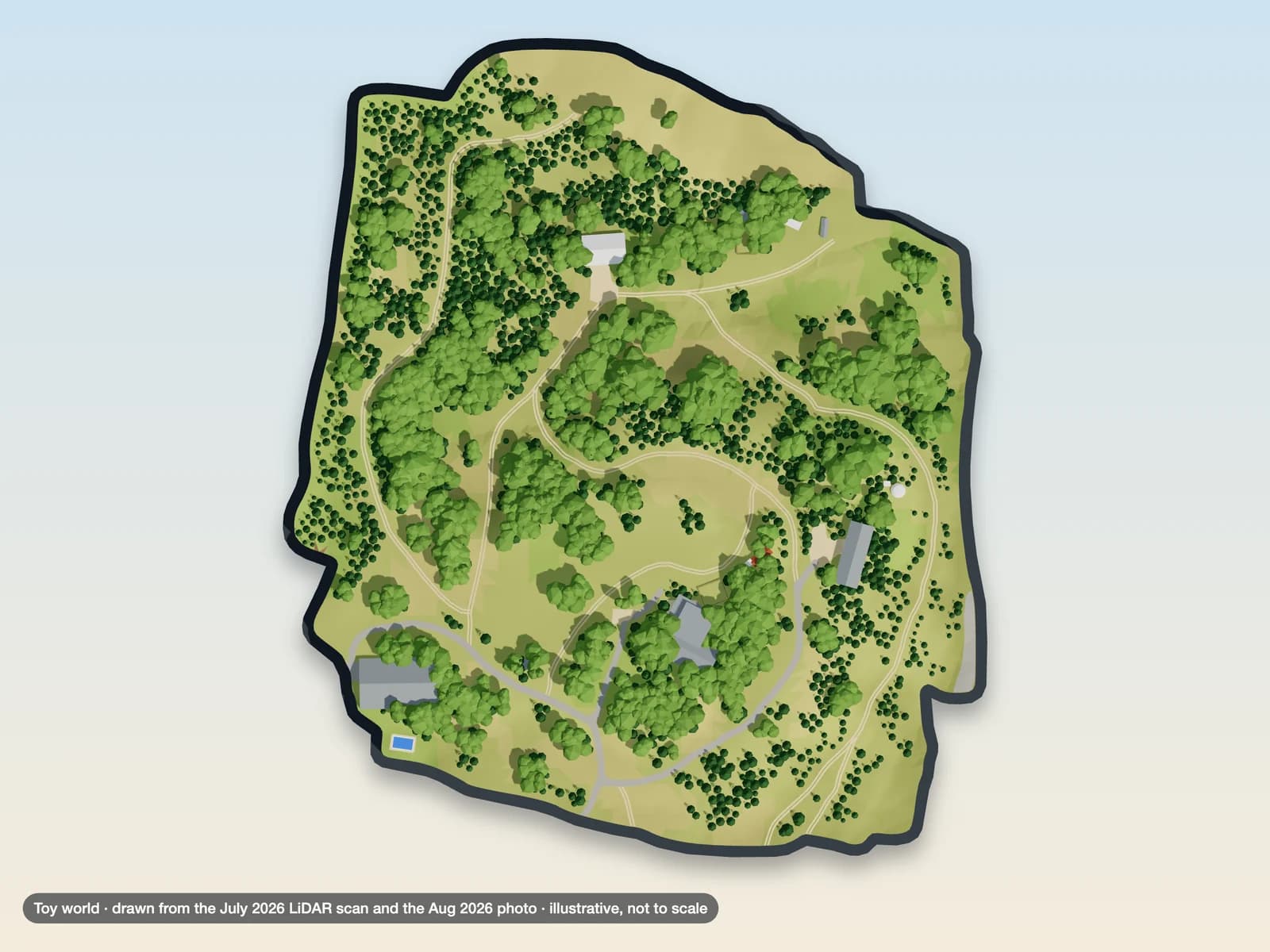
The same world, straight down
We draw it from the scan that makes your map and 3D model: the roads, the buildings, the trees and the water. Your points and trails ride on it, and it shares with a link like any other view.
It is a picture, not a measurement: it is not to scale, so no distance, area or height can be read off it. It opens as its own tab on your property's page.
On paper, on request: a Property Key, route cards, or one handover PDF — or a Field Pack file for a phone with no signal.
A route on this page is a path recorded over this property from our own mapping — a line to walk or fly, and nothing more. It is not a road, an easement, or a right of way, and it is not a statement that the ground it crosses is maintained, legally accessible, or safe to travel on foot or by vehicle. Conditions on the ground govern: check them before relying on a route.
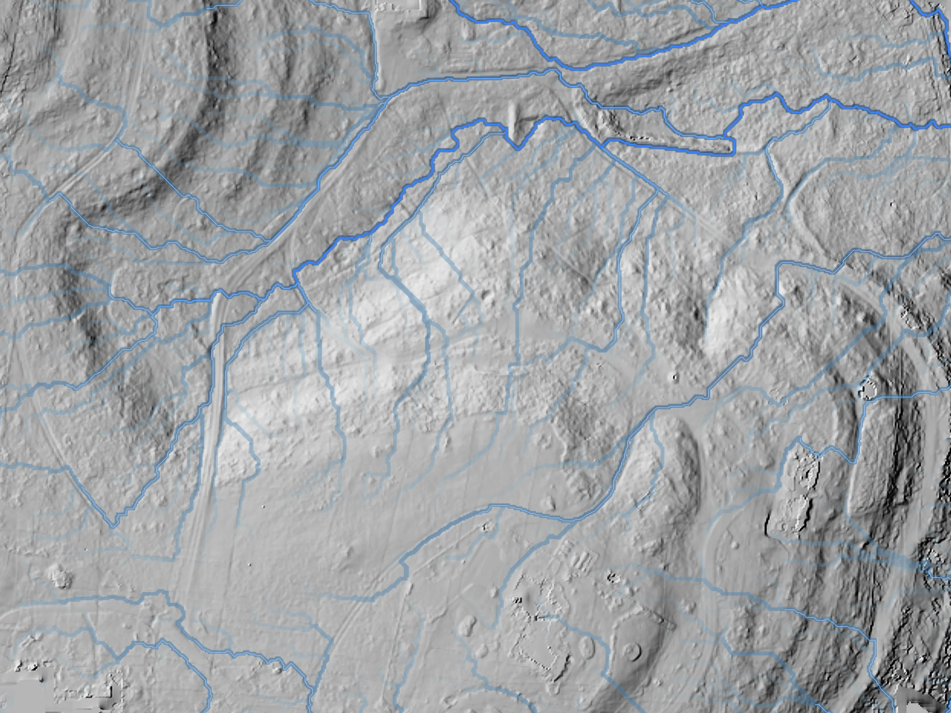
Where your water goes — modeled, and checkable
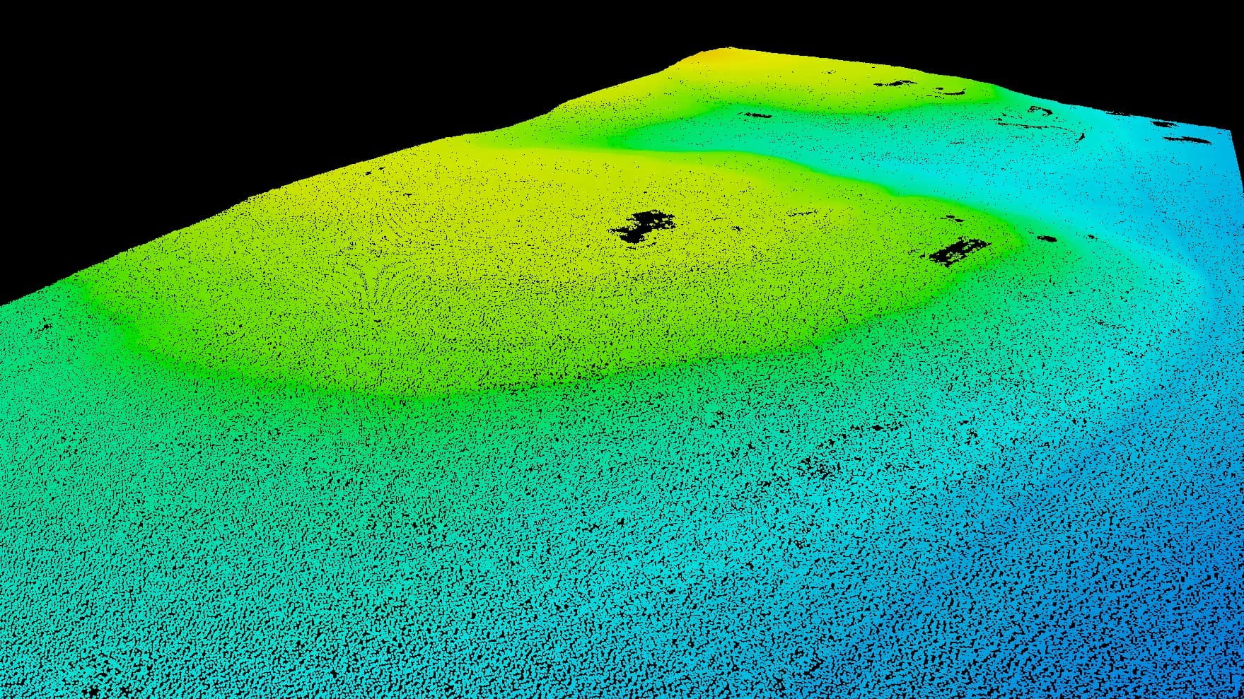
The same flight's elevation data models the flow paths, the channels, and where water tends to linger. See it on a real property first.
Deliver these maps under your own brand
Agencies, engineering firms, and multi-site operators can hand our maps to their own clients. You keep the client; we do the flying and run the platform.
Hosted viewer
We host the viewer and keep it online. Nothing for your clients to install, nothing for you to run.
White-label branding
Your logo and colors on the viewer your clients open.
Embed on your own site
Put the live viewer in your own website or client portal.
For your own venue, Venue Maps puts the same branding on a hosted map of your property.
On the horizon
If it matters to your project, ask where it stands.
Thermal Imaging
In the worksA heat map of where a roof, solar array, or field read warmer or cooler than its surroundings. It marks the spots worth checking on the ground — where to look, never what's wrong.
Service comparison
Live services only. Delivery time depends on your property's size and what we set up for you, so your quote sets it.
Aerial Mapping
- Accuracy
- 2–5 cm horizontal · 5–10 cm vertical
- Best for
- Construction, real estate, earthwork
Laser Scanning
- Accuracy
- —
- Best for
- Wooded land, terrain mapping, drainage
Service areas
We fly the Hill Country and the I-35 corridor, and for the right project we travel anywhere in the country.
Counties and towns we serve
- Hays County: Dripping Springs, Driftwood, Wimberley, Buda, Kyle, San Marcos
- Travis County: Austin, Westlake Hills, Pflugerville, Bee Cave, Lakeway
- Williamson County: Round Rock, Cedar Park, Leander, Georgetown, Liberty Hill
- Blanco County: Johnson City, Blanco
- Comal County: New Braunfels, Canyon Lake, Bulverde
- Burnet County: Marble Falls, Burnet
- Gillespie County: Fredericksburg
- Kendall County: Boerne, Comfort
- Bexar County: San Antonio
- Guadalupe County: Cibolo, Seguin
- Caldwell County: Lockhart
- Bastrop County: Bastrop
Let's map your project
Tell us about your site and we'll come back with a plan and a free quote — same day, from the pilot.