
A precise, interactivemap of your property.
Know your land down to the centimeter — a living map you can open in any browser: walk it in 3D, measure anything, and name every gate, tank, trail, and fence line in your own words. Nothing to install.
Or see what a mapping job includesFlown this week
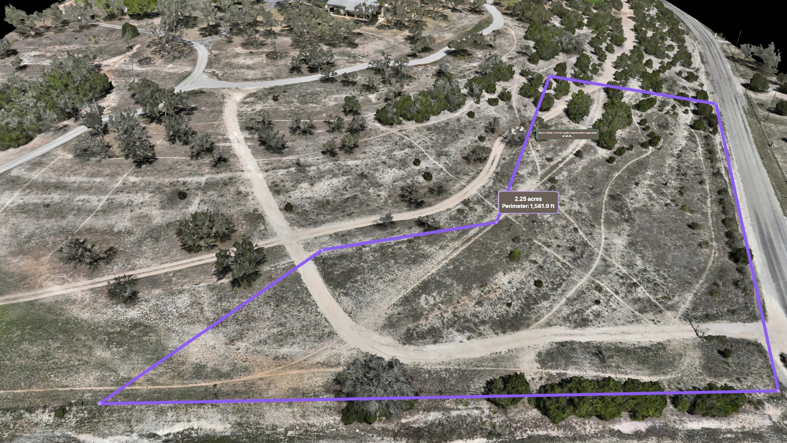
Public imagery is years old. We fly it this week.
Drag to compare the public aerial view of the ground with a fresh Embry flight.
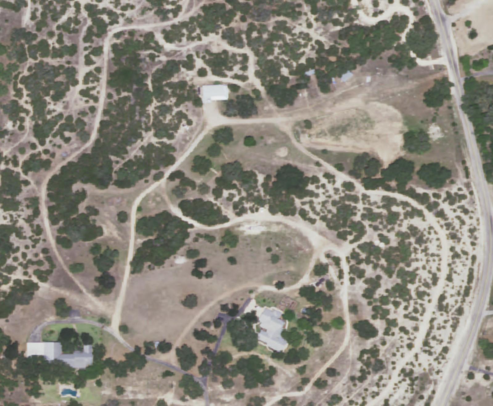
Public aerial imagery (NAIP) — older, coarse.
An Embry flight of this ranch — the freshness you get when we fly yours this week.
Not just a map — a tool you work in
Every flight opens in your own private viewer — sharp enough to go from “is that a tree?” to “look at that leaf.”
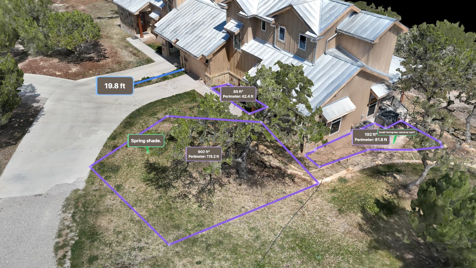
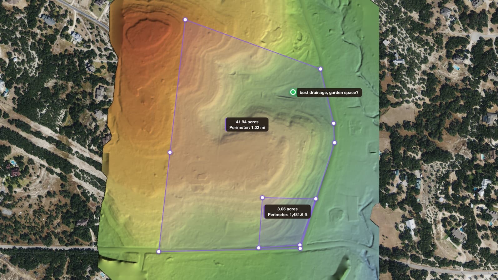
Measure, pin, and mark up — right on your land.
See it every way
- Flat map or full 3D
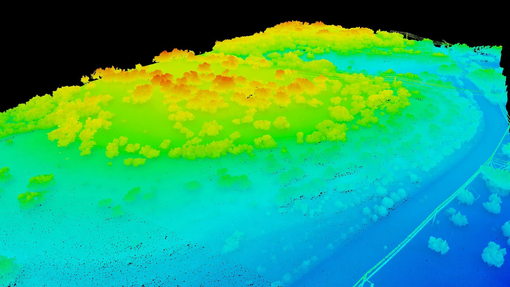
- LiDAR that sees through the trees
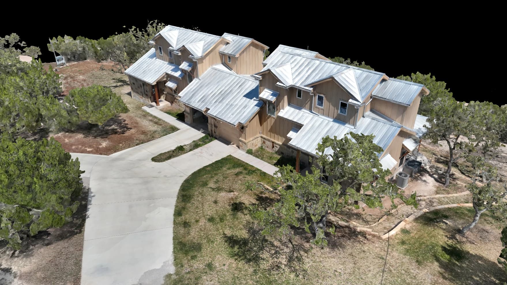
- Photoreal — like you're standing there
- A flyover of your land
Measure anything
- Any distance or area in a click
- Your exact acreage
- Cut & fill dirt volumes
- Pins and notes — then talk them through with us
See what changed
- Two flights side by side
- Every change over time
- Slice an elevation profile
- Slopes, lows & drainage
Share & take action
- A share link — no login, no app
- Ask the built-in AI about your land
- Your brand on the viewer, white-label
- Screenshots, a PDF, or a printable 3D file
One ranch. Every layer.
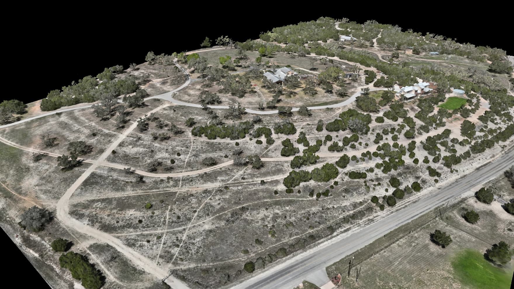
Our own Hill Country ranch, as the mapping flight, the LiDAR, the thermal camera and the 3D viewer see it. Tap through the layers.
 Photo
PhotoThe whole property straight down, sharp enough to count fence posts — measure on it, mark it up, share it.
Flight · Aug 2026 · 0.9 cm/px
Drainage, flow, terrain, and floodplain layers are derived analysis computed from our elevation data to support planning and design. They are not a certified survey, a stamped engineering study, or a FEMA flood-zone determination.
Don't take our word for it — download the files
Here's a real sample set from our own 40-acre Hill Country ranch. The contours drop into AutoCAD, and the layers open in any GIS or map app.
Coordinate system: WGS 84 / UTM Zone 14N (EPSG:32614), Central Texas. Drainage, flow, terrain, and floodplain layers are derived analysis computed from our elevation data to support planning and design. They are not a certified survey, a stamped engineering study, or a FEMA flood-zone determination. This data is not a legal survey. Embry Solutions LLC does not perform land surveys. For boundary, subdivision, or title surveys, please consult a licensed Texas surveyor.
On paper, on request: a Property Key, route cards, or one handover PDF — or a Field Pack file for a phone with no signal.
A route on this page is a path recorded over this property from our own mapping — a line to walk or fly, and nothing more. It is not a road, an easement, or a right of way, and it is not a statement that the ground it crosses is maintained, legally accessible, or safe to travel on foot or by vehicle. Conditions on the ground govern: check them before relying on a route.
How a project moves
From the first call to a live map you can measure.
Tell us the problem
Free consultation. We work out what to fly and what you get.
Fly the property
Drone mapping or LiDAR — plus handheld scans where the drone can't see.
Process
Our own machines turn the flight into maps, models and measurements.
Deliver
A live viewer of your land, with the files on your quote on the same page.
From flight to interactive 3D
Every flight also brings 3D scans, photoreal models and elevation maps to your browser. Ask about flyover videos, too.
Public LiDAR is a starting point. We fly the detail.
Free public elevation data covers the whole state at about a one-meter grid. An Embry flight captures your land at centimeter scale — enough to see the drainage, the pad, and the cut.
Public USGS 3DEP LiDAR
Free, statewide baseline
~1 m grid
~1–2 points / m²
An Embry flight
Flown for your property
Centimeter-scale
Dense — orders of magnitude more points / m²
Built for the way you work the land
Every project is delivered on your own interactive platform.
Frequently Asked Questions
Common questions about our mapping services. Anything else, reach out directly — every project is scoped individually.
Ten acres usually takes 30–45 minutes in the air; LiDAR flies lower and longer. It's usually done in half a day. Delivery time depends on your property's size and what we set up for you, so your quote sets it.
Very little. Give us access and tell us about power lines, restricted airspace, or active construction. We handle the flight plan, the FAA authorizations, and the equipment.
Delivery time depends on your property's size and what we set up for you, so your quote sets it. Rush is available on smaller sites, at extra cost. You get the interactive viewer and the files on your quote.
Our maps land within 2–5 cm horizontally and 5–10 cm vertically — versus the few meters everyday GPS gives you. That isn't a legal boundary survey, but it's plenty for tracking construction, measuring dirt and volumes, and planning a site.
Yes. Contours come as DXF for AutoCAD and Civil 3D, and as KMZ for any GIS or map app, all in WGS 84 / UTM Zone 14N. There's a real sample set to download on this page.
Yes. From your elevation data we model the flow paths, the channel network, and the wet ground. Drainage, flow, terrain, and floodplain layers are derived analysis computed from our elevation data to support planning and design. They are not a certified survey, a stamped engineering study, or a FEMA flood-zone determination.
No. It's mapping, accurate to 2–5 cm horizontally and 5–10 cm vertically — enough to plan, measure, and document from. For boundary, title, or subdivision work, engineering design, or construction staking, bring in a licensed Texas surveyor or engineer.
We're FAA Part 107 certified. Near airports or in restricted airspace we get LAANC authorization, usually within minutes, and we handle the paperwork.
Camera mapping turns photos into maps and 3D models, best on open ground. LiDAR's laser sees through tree cover to the ground underneath, so it's the choice for wooded land. We can help you decide.
Based in Dripping Springs, TX, we mostly fly the Hill Country, from Austin to San Antonio. That's where we advertise, not a fence: for the right project we travel anywhere in the country. The quote says what travel adds.
Every project is scoped on acreage, terrain, and deliverables. Ask for a free consultation and we'll send a quote.
Let's map your property
Free flight plan and quote, no obligation.